Ocean swells however, will be felt over a much larger area, reached the U.S. east coast on Oct. 16. Large swells generated by Gonzalo are affecting portions of the Virgin Islands, the northern coasts of Puerto Rico and the Dominican Republic and portions of the Bahamas. Swells will reach much of the east coast of the United States and Bermuda on Thursday.
By late Oct. 16, Gonzalo is expected to turn to the northeast and the center is expected to approach Bermuda sometime on Oct. 17.
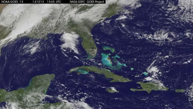
This animation of visible and infrared images from NOAA's GOES-East satellite shows the movement and strengthening of Gonzalo from a tropical storm on Oct. 13 to a hurricane on Oct. 15 north of Puerto Rico.
(Photo Credit: Image : NASA/NOAA GOES Project)
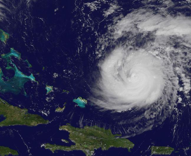
On Oct. 15 at 11:15 a.m. EDT NOAA's GOES-East satellite saw Gonzalo had tightly wrapped bands of thunderstorms spiraling into the center of its circulation.
(Photo Credit: Image : NASA/NOAA GOES Project)
Source: NASA/Goddard Space Flight Center