By May 29 at 23:15 UTC (5:45 p.m. EDT), the circulation was barely identifiable on GOES-West satellite imagery as the post-tropical cyclone moved east toward mainland Mexico.
On May 30, the remnant low pressure area formerly known as Amanda was located near 17.0 north latitude and 109 west longitude. The minimum central pressure of the remnant low was near 1008 millibars. The NHC noted "Although this low is currently Embedded within a broad area of deep moisture...upper level drier air is starting to approach from the northwest."
GOES satellites provide the kind of continuous monitoring necessary for intensive data analysis. Geostationary describes an orbit in which a satellite is always in the same position with respect to the rotating Earth. This allows GOES to hover continuously over one position on Earth's surface, appearing stationary. As a result, GOES provide a constant vigil for the atmospheric "triggers" for severe weather conditions such as tornadoes, flash floods, hail storms and hurricanes.
Now that Amanda has faded into hurricane history as the strongest May hurricane on record in the Eastern Pacific, forecasters and satellites are now keeping an eye on a developing area of disturbed weather several hundred miles south of southeastern Mexico.
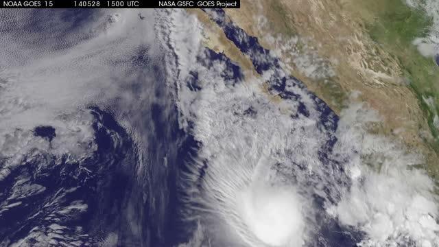
This animation of visible and infrared imagery from NOAA's GOES-West satellite shows the weakening of Hurricane Amanda from May 28 to its dissipation on May 30.
(Photo Credit: Image : NASA/NOAA GOES Project)
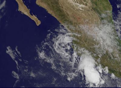
This image from NOAA's GOES-West satellite on May 30 shows remnant clouds from post-tropical cyclone Amanda near the western coast of Mexico.
(Photo Credit: Image : NASA/NOAA GOES Project)
Source: NASA/Goddard Space Flight Center