The TRMM data was overlaid on an infrared image from NOAA's GOES-East satellite that showed the extent of the clouds at the same time. TRMM's PR instrument found rain falling at a rate of over almost 163 mm (about 6.4 inches) per hour in an intense line of storms extending from Arkansas into Texas.
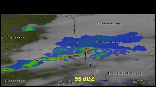
TRMM noticed that some of the highest thunderstorms topped out at around 11 km (6.8 miles) high. Some of these powerful storms were returning reflectivity values of over 55dBZ to the satellite.
The TRMM satellite flew above tornado spawning thunderstorms in the southern United States on May 9, 2014 at 0115 UTC. This simulated 3-D TRMM animation shows the location of intense radar echoes within the stormy area.
(Photo Credit: Image : SSAI/NASA, Hal Pierce)
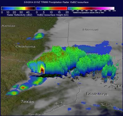
The TRMM satellite flew above tornado spawning thunderstorms in the southern United States on May 9, 2014 at 0115 UTC.
(Photo Credit: Image : SSAI/NASA, Hal Pierce)
Source: NASA/Goddard Space Flight Center