NASA's Terra satellite passed Tropical Cyclone Bansi on January 13 when it was about 170 nautical miles (195 miles/314 km) north of the Island of Mauritius and a major hurricane in the Southern Indian Ocean.
The Moderate Resolution Imaging Spectroradiometer or MODIS instrument aboard NASA's Terra satellite captured a visible image of Tropical Cyclone Bansi on January 13 at 6:25 UTC (1:25 a.m. EST). The image revealed a 12 nautical mile-wide visible eye with high, powerful thunderstorms ringed around it, and spiraling bands of thunderstorms wrapping into the center of circulation. The eye of Bansi appears a couple of hundred miles north of Mauritius.
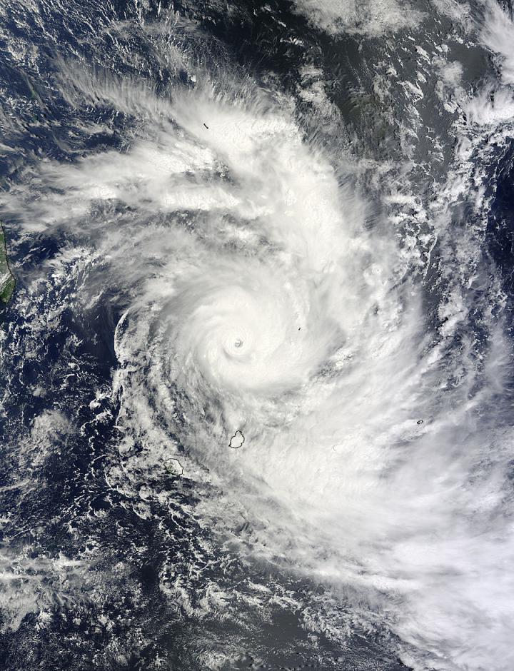 NASA's Terra satellite captured this visible image of Tropical Cyclone Bansi on January 13 at 6:25 UTC (1:25 a.m. EST). Credit: NASA's Goddard MODIS Rapid Response Center
On January 13 at 0900 UTC (4 a.m. EST), Bansi's maximum sustained winds had increased to 130 knots (149.6 mph/240.8 kph). Bansi is a Category 4 hurricane on the Saffir-Simpson wind scale. At 0900 UTC, it was centered near 17.3 south latitude and 57.7 east longitude, about 169 nautical miles (194.5 miles/313 km) north of Port Louis, Mauritius. Bansi is moving to the northeast at 4 knots (4.6 mph/7.4 kph).
Mauritius remains under a tropical cyclone warning class 2 and La Reunion Island remained on Yellow pre-alert on January 13. Bansi is creating very rough seas, with maximum wave heights to 30 feet. (9.1 meters)
The Joint Typhoon Warning Center noted that slow or near quasi-stationary movement is expected over the next 36 hours due to a weak steering environment. Over that time, some intensification is likely, and the cyclone is forecast to peak as a Category 5 storm on the Saffir-Simpson Scale at 140 knots (161.1 mph/259.3 kph) before starting to weaken.
The forecast calls for Bansi to continue moving away from Mauritius and head in an easterly direction over open waters of the Southern Indian Ocean.