This particular dataset consists of a 5,300-geophone network—deployed as part of a hydrocarbon industry survey—covering an area of more than 70 km2. Geophone devices are commonly used to record energy waves reflected by the subsurface geology as a way of mapping out geologic structures or track earthquakes.
"By recording vibrations via geophones spaced roughly every 100 meters (300 feet), we were able to look into activity in Long Beach with a resolution below a typical city block," said Riahi.
This begs the question: What urban processes can the space and time structure of vibrational intensity reveal?
Much to their surprise, Riahi and Gerstoft discovered that "by using mostly standard signal processing, we can follow a metro schedule, count aircraft and their acceleration on a runway, and even see larger vehicles on a 10-lane highway." More refined techniques and algorithms may well uncover many other types of manmade signals within the Earth.
These findings indicate that urban vibrations can serve as a new data source to observe cities. "Traffic monitoring tasks are an important and obvious application, but other uses may be involved in urban area characterization in which the type and schedule of activities can be visualized, so that it's possible to vibrationally identify industrial, residential or office zones," Riahi added.
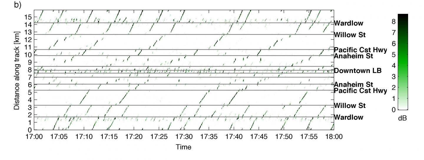
This is a close-up of a 2-mile section of the metro track in Long Beach, Calif., showing vibrations as two trains pass.
(Photo Credit: Riahi/Scripps Oceanographic Institution)
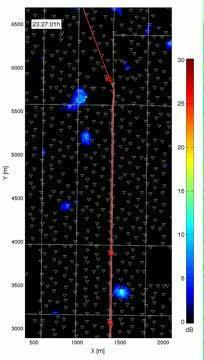
This image shows the vibrational signature of Blue Line Metro trains as they move through Long Beach, Calif.
(Photo Credit: Riahi/Scripps Oceanographic Institution)
Source: Acoustical Society of America