GOES-13 is one of several satellites keeping track of Tropical Storm Arlene. Because GOES-13 monitors the eastern U.S. and the Atlantic, and Arlene is moving west, the GOES-11 satellite is going to pick up watching Arlene's movements. GOES-11 monitors the western U.S. and the eastern Pacific Ocean.
Both GOES-13 and GOES-11 are operated by NOAA. NASA's GOES Project creates images and animations from both satellites, and used the continuous data from GOES-13 to make a two-day movie showing Arlene's landfall today. NASA's GOES Project works out of the NASA Goddard Space Flight Center in Greenbelt, Md.
The animation shows Arlene from June 28 at 1415 (10:15 a.m. EDT) to June 30 at 1415. In those two days, the circulation of Arlene became more apparent as the center moved away from the Yucatan Peninsula and into the southwestern Gulf of Mexico. Satellite imagery also showed that eastern side of the storm contained more cloud cover when it was over open ocean.
The National Hurricane Center noted that the center of Arlene should continue moving inland over mainland Mexico today and will likely dissipate over the central Mexico mountains sometime on Friday, July 1.
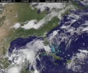
This movie of GOES-13 satellite imagery of Tropical Storm Arlene in 15 minute intervals from June 28 at 1415 (10:15 a.m. EDT) to the same time on June 30, shows the storm making landfall in northeastern Mexico near Cabo Rojo.
(Photo Credit: NASA/NOAA GOES Project, Dennis Chesters)
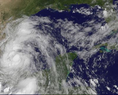
The GOES-13 satellite captured this image of Tropical Storm Arlene at 1431 UTC (10:31 a.m. EDT) on June 30, 2011 as it was inland and just west of Cabo Rojo, Mexico.
(Photo Credit: : NASA/NOAA GOES Project)
Source: NASA/Goddard Space Flight Center