Tropical Depression Nine formed over the western Bay of Campeche, Gulf of Mexico and is forecast to make a quick landfall on Mexico's Yucatan Peninsula. NOAA's GOES-East Satellite captured the birth of the depression.
NOAA's GOES-East Satellite captured an image of the birth of Tropical Depression 9 on Oct. 22 at 1600 UTC (12 p.m. EDT) in the western Bay of Campeche. The clouds associated with the depression stretched over the Yucatan Peninsula and into the western Caribbean Sea.
On Oct. 22, a Tropical Storm Warning was in effect from Celestun to Frontera, Mexico. The National Hurricane Center noted that the center of tropical depression nine (TD9) was located near latitude 19.4 north and longitude 92.4 west. The depression is stationary, but a slow eastward motion should begin later today. On the forecast track...the center of the Tropical cyclone will be near the coast of the Mexican State of Campeche tonight or early Thursday. Maximum sustained winds remain near 35 mph (55 kph) and the depression could become a tropical storm before it moves inland.
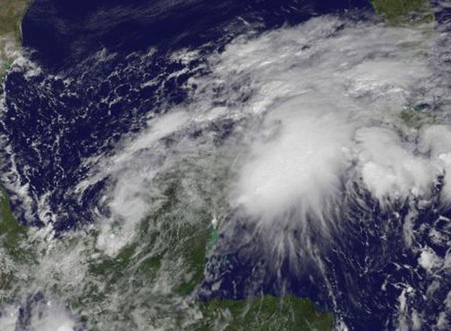
NOAA's GOES-East Satellite captured the birth of Tropical Depression 9 on Oct. 22 at 1600 UTC (12 p.m. EDT) in the western Bay of Campeche.
(Photo Credit: NASA/NOAA GOES Project)
The depression is expected to produce total rainfall accumulations of 5 to 10 inches across the Yucatan Peninsula of Mexico with a maximum of 15 inches possible. These rainfall amounts may produce life-threatening flash floods. Tropical storm conditions are expected to begin in portions of the warning area by late this afternoon or evening.
Tropical Depression 9 is expected in intensify to tropical storm strength before making landfall in the Yucatan Peninsula.
Source: NASA/Goddard Space Flight Center