At 5:05 a.m. PDT on Monday, October 27, Environment Canada's Meteorological Service posted a Wind warning in effect for British Columbia's Central coast, Vancouver Island, Haida Gwaii, North Vancouver Island, and the Sunshine Coast. The warning noted strong winds may cause damage are expected or occurring. In addition, there will likely be heavy rainfall associated with the system and rainfall amounts of 50 to 75 mm (~2 to 3 inches) are possible for tonight into Tuesday.
The EC noted that the remains of Tropical Storm Ana will move towards the British Columbia Coast later today (Oct. 27) and tonight. Southeast winds are forecast to increase to 90 kph (56 mph) over exposed coastal sections by this evening. Winds will then gradually ease through Tuesday morning.
Environment Canada meteorologists will update alerts as required. For updates, visit: http://weather.gc.ca.
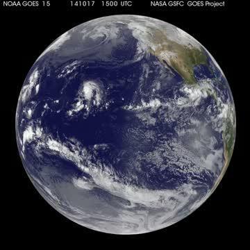
This animation of NOAA's GOES-West satellite imagery from Oct. 1 -27 shows the movement of Tropical Storm Ana as it heads toward British Columbia, Canada. TRT: 00:20.
(Photo Credit: Image : NASA/NOAA GOES Project)
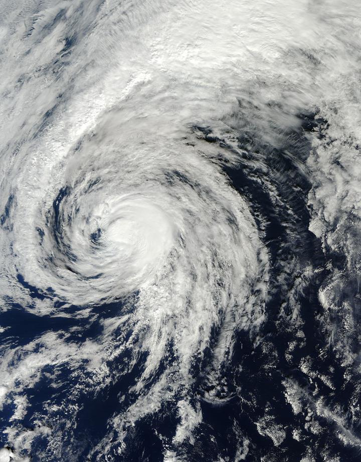
NASA's Terra satellite captured this visible image of Tropical Storm Ana in the Central Pacific Ocean on Oct. 25 at 21:00 UTC (5 p.m. EDT).
(Photo Credit: Image : NASA Goddard MODIS Rapid Response Team)
Source: NASA/Goddard Space Flight Center