Former Tropical Cyclone 17S was battered by northerly vertical wind shear and reduced to a remnant low pressure area in the Southern Indian Ocean. NASA-NOAA's Suomi NPP satellite passed over the system on March 30 captured a visible image of the large area of remnant clouds streaming to the southeast.
On Mar. 30 at 08:46 UTC (4:46 a.m. EDT) the Visible Infrared Imaging Radiometer Suite (VIIRS) instrument aboard NASA-NOAA's Suomi NPP satellite captured a visible image of clouds associated with the remnant low pressure area. The poorly-defined center circulation was barely distinguishable in the imagery and clouds were pushed southeast of the center. VIIRS collects visible and infrared imagery and global observations of land, atmosphere, cryosphere and oceans.
The final bulletin from the Joint Typhoon Warning Center was issued on March 30 at 0900 UTC (5 a.m. EDT). At that time, Tropical Cyclone 17S was centered near 25.8 degrees south latitude and 82.9 degrees east longitude, about 1,270 nautical miles south-southeast of Diego Garcia. It was moving to the southeast at 31 knots (35.6 mph/57.4 kph) and had maximum sustained winds near 35 knots (40 mph/62 kph). The storm was still a tropical storm at that time and weakening quickly from the strong vertical wind shear.
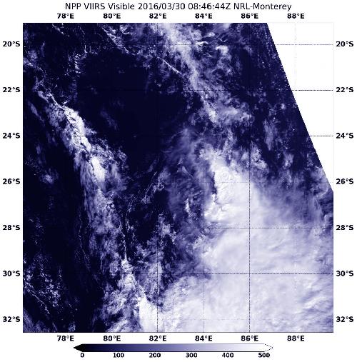 On March 30 at 08:46 UTC (4:46 a.m. EDT), the VIIRS instrument aboard NASA-NOAA's Suomi NPP satellite captured this visible image of the remnant clouds of former tropical cyclone 17S. Credit: Credits: NASA Goddard Rapid Response/NOAA
By 1500 UTC (11 a.m. EDT) the low-level center deteriorated into a low level trough, or elongated area of low pressure.
source: NASA/Goddard Space Flight Center