NOAA's GOES-East satellite has been keeping an eye on the remnants of Tropical Depression 9.
On Oct. 24 at 14:30 UTC (10:30 a.m. EDT) GOES-East captured a visible image of clouds and thunderstorms associated with former Tropical Depression 9,, centered over the southeastern Yucatan Peninsula of Mexico, Belize, and the adjacent northwestern Caribbean Sea.
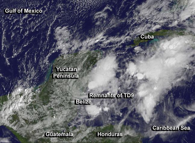
On Oct. 24 at 14:30 UTC (10:30 a.m. EDT) GOES-East captured a visible image of clouds and thunderstorms centered over the southeastern Yucatan Peninsula of Mexico, Belize, and the adjacent northwestern Caribbean Sea.
(Photo Credit: Image : NASA/NOAA GOES Project)
NOAA's National Hurricane Center (NHC) noted that surface pressures were rising in the area, and the re-development of the former depression is unlikely. The remnants are expected to continue moving east over the next day or two. NHC gives the remnants a low chance, just 10 percent, of re-forming into a depression over the next couple of days.
Source: NASA/Goddard Space Flight Center