NASA's Aqua satellite passed over newborn Tropical Storm Phanfone on Sept. 29 and captured a picture of the storm that showed thunderstorms wrapped tightly around the storm's center, and a large band of thunderstorms spiraling into the center from the east. Phanfone is now a threat to various islands and warnings are in effect.
A tropical storm Warning is in effect for Saipan, Tinian, Pagan and Alamagan. In addition, a typhoon watch is in effect for the northern Marianas Islands, including Pagan and Alamagan.
The Moderate Resolution Imaging Spectroradiometer (MODIS) aboard Aqua provides visible and infrared images of storms, oceans and land features.
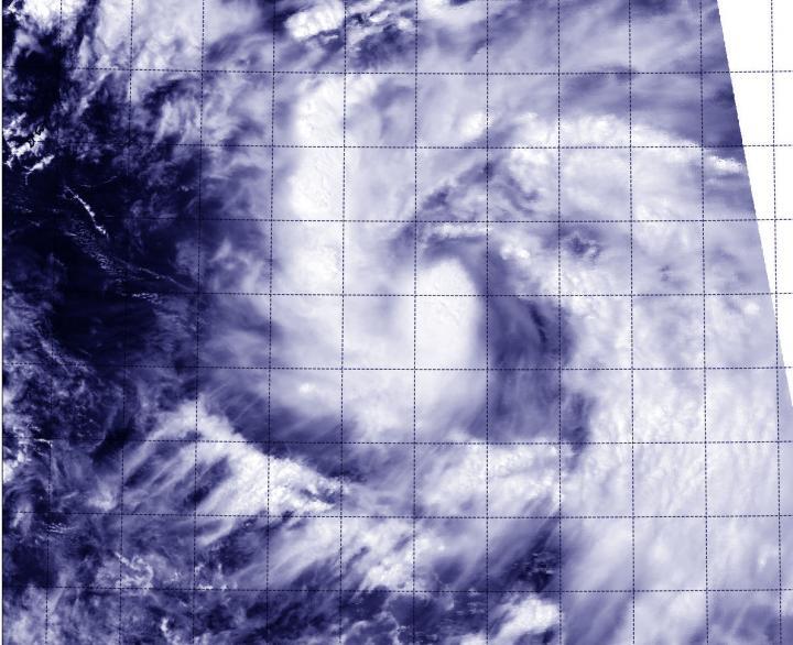
The MODIS instrument aboard NASA's Aqua satellite took this visible image of Tropical Storm Phanfone in the Northwestern Pacific, on track for the Northern Marianas Islands.
(Photo Credit: NASA Goddard MODIS Rapid Response Team)
On Sept. 29 at 11 a.m. EDT (1500 UTC) Phanfone had maximum sustained winds near 40 knots (46 mph/74 kph). It was centered near 13.8 north latitude and 149.6 east longitude, about 270 nautical miles east-southeast of Saipan. Phanfone is moving to the west-northwest at 11 knots (12.6 mph/20.3 kph).
The U.S. National Weather Service in Guam issued a statement on Sept. 29 about Phanfone's approach: "Tropical Storm Phanfone will be strengthening into a typhoon as it crosses the Northern Mariana Islands with the center passing near...most likely north of Saipan on Sept. 30, Tuesday night or early Wednesday, Oct. 1. It is important to note that only small changes in the forecast track and intensity will lead to significantly varying Impacts. Expect heavy rain...thunderstorms...dangerous surf...and damaging winds." For forecast updates, visit: http://forecast.weather.gov/MapClick.php?map.x=249&map.y=58&site=gum
Forecasters at the Joint Typhoon Warning Center expect Phanfone to intensify as it moves to the west-northwest toward the Marianas Islands. After passing through the islands, Phanfone is expected to reach typhoon strength and move west of the island of Iwo To by Oct. 2 or 3.
Source: NASA/Goddard Space Flight Center