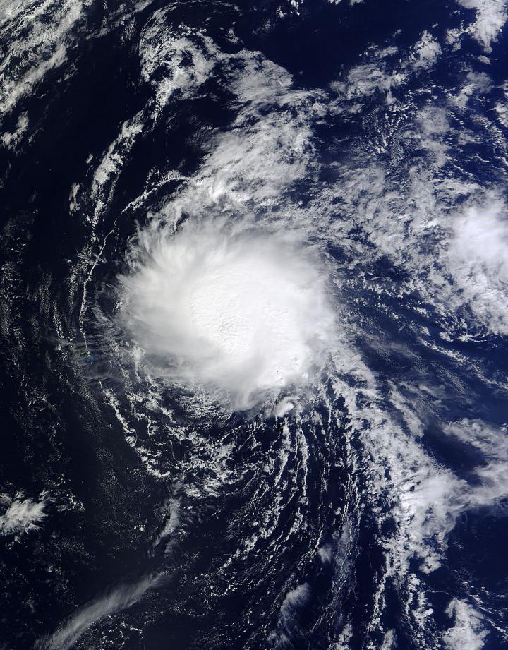
The strong southwesterly wind shear that has been battering Tropical Storm Ana has abated and has given the storm a chance to re-organize. Ana appeared more rounded on imagery from NASA's Terra satellite as thunderstorms again circled the low-level center.
NASA's Terra satellite passed over Ana on Oct. 22 at 22:10 UTC (6:10 p.m. EDT). The MODIS instrument aboard Terra captured a visible image of the storm that showed clouds and showers were no longer being blown northeast of the center from southwesterly wind shear, as they had in the last couple of days. The wind shear has weakened, which allowing for the showers and thunderstorms to redevelop around the center of the storm.
On Oct. 24, Ana was strengthening and moving northwest while crossing the northwest Hawaiian Islands east of Maro Reef.

NASA's Terra satellite passed over Tropical Storm Ana on Oct. 22 at 22:10 UTC (6:10 p.m. EDT) and saw that wind shear had relaxed.
(Photo Credit: Image : NASA Goddard MODIS Rapid Response Team)
A Tropical Storm Warning is in effect for portions of the Papahanaumokuakea Marine National Monument, from French Frigate Shoals to Lisianski.
At 8 a.m. (2 a.m. HST/1200 UTC) the center of Tropical Storm Ana was located near latitude 26.0 north and longitude 168.6 west. Ana was moving toward the northwest near 12 mph (19 kph) and this motion is expected to become more northerly through early Friday, then northeasterly through early Saturday, Oct. 25. Maximum sustained winds were near 50 mph (80 kph).
NOAA's Central Pacific Hurricane Center expects Ana to continue strengthening through early Saturday.
Source: NASA/Goddard Space Flight Center