At 5 a.m. EDT on Wednesday, August 20, the National Hurricane Center (NHC) noted that curved bands of thunderstorms remained well organized on the south side of the circulation, but strong showers and thunderstorms were lacking to the north of the center.
At the same time, the center of Tropical Storm Lowell was located near latitude 18.7 north and longitude 121.0 west. That's about 775 miles (1,245 km) west-southwest of the southern tip of Baja California. Maximum sustained winds remain near 50 mph (85 kph). Lowell was moving toward the northwest near 5 mph (7 kph) and the NHC expects a slow northwest to north-northwest motion during the next day or so.
Forecaster Cangialosi at NHC noted that Lowell is currently over 27C/80.6F waters, and in an atmosphere of fairly low shear and high moisture. Tropical cyclones need waters at least near 26.6C/80F to maintain strength. Since the storm is expected to remain in these favorable conditions for another day and a half, some strengthening is forecast.
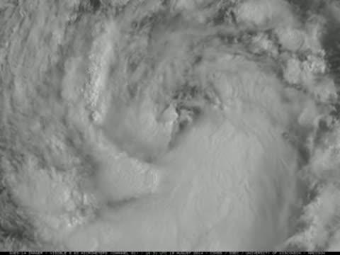
NOAA's GOES-14 satellite was brought out of storage and put in Super Rapid Scan Operations for GOES-R mode and data of Tropical Storm Lowell from Aug. 19 was animated.
(Photo Credit: Image : UW-M/SSEC/NOAA)
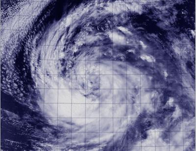
The VIIRS instrument that flies aboard NASA-NOAA's Suomi NPP satellite captured a visible image of Tropical Storm Lowell on Aug. 19 at 5:42 p.m. EDT.
(Photo Credit: Image : NRL/NASA/NOAA)
Source: NASA/Goddard Space Flight Center