Tropical Storm Kammuri continues to appear more like a cold front on satellite imagery as it transitions into an extra-tropical storm over the Northwestern Pacific Ocean.
When NASA's Terra satellite passed over Kammuri on Sept. 29 at 7:40 a.m. EDT (11:40 UTC), the Moderate Resolution Imaging Spectroradiometer or MODIS instrument captured an infrared look at the storm. MODIS showed that the bulk of strong storms elongated from southwest to northeast.
On Sept. 29, 2014 at 0300 UTC (Sept. 28 at 11 p.m. EDT) Tropical Storm Kammuri had maximum sustained winds near 45 knots (51.7 mph/83.3 kph). It was centered near 34.1 north latitude and 147.3 east longitude over the open waters of the Northwestern Pacific Ocean. The center is 320 nautical miles away from mainland Japan.
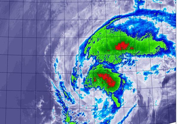
On Sept. 29 NASA's Terra satellite saw the bulk of strong storms within Tropical Storm Kammuri were stretched out. The storm had elongated from southwest to northeast.
(Photo Credit: NASA/NRL)
Kammuri was moving to the northeast at 14 knots (16.1 mph/25.9 kph) and is becoming embedded in the westerlies (winds). Forecasters at the Joint Typhoon Warning Center expect Kammuri to be fully extra-tropical by Sept. 30 as it continues to weaken over the open ocean. When a storm becomes extra-tropical its core goes from warm to cold, like a typical mid-latitude low pressure (storm) system.
The Joint Typhoon Warning Center has closed the books on Kammuri but noted that it will be watched for regeneration.
Source: NASA/Goddard Space Flight Center