Tropical Cyclone Fantala continued to spin northeast of Madagascar when NASA's Aqua satellite passed over the Southern Indian Ocean on April 20.
The Moderate Resolution Imaging Spectroradiometer or MODIS instrument that flies aboard Aqua captured a visible image of the Category 2 hurricane on the Saffir-Simpson Scale on April 20 at 10:10 UTC (6:10 a.m. EDT). The storm had decreased from its Category 5 status on April 18. The MODIS image continued to show good circulation with a wide, clear eye, surrounded by powerful thunderstorms.
At 0900 UTC (5 a.m. EDT) Tropical cyclone Fantala's maximum sustained winds were near 105 knots (120.8 mph/194.5 kph). Hurricane force winds extend out to about 30 nautical miles (34.5 miles/55.5 km) from the center of circulation, and tropical storm force winds extend out up to 115 nautical miles from the center. The Joint Typhoon Warning Center (JTWC) expects Fantala to re-strengthen a little more before starting a weakening trend.
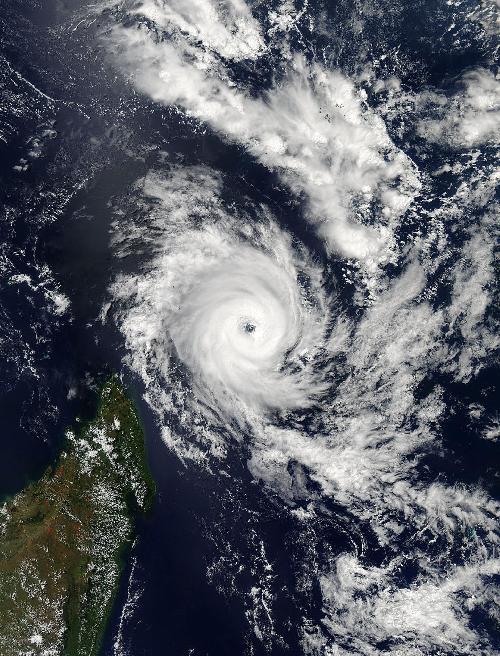 On April 20 at 10:10 UTC (6:10 a.m. EDT) the MODIS instrument aboard NASA's Aqua satellite continued to show Fantala had good circulation with a wide, clear eye, surrounded by powerful thunderstorms. Credit: Credits: NASA Goddard MODIS Rapid Response
Fantala was centered near 10.5 degrees south latitude and 52.7 degrees east longitude, about 634 nautical miles (729 miles/1,174 km) north-northwest of Port Louis, Mauritius. Fantala was moving to the east-southeast at 9 knots (10.3 mph/16.6 kph).
For updated forecasts from the Madagascar Meteorological Service (MMS) (in French), visit: http://www.meteomadagascar.mg/. Fantala continues to generate rough seas, with wave heights to 33 feet (10.6 meters). The MMS noted that "output at sea offshore, beyond the coast (55 miles) 90 kilometers is not recommended."
Fantala is expected to curve back toward the west and head back toward Madagascar while weakening.
source: NASA/Goddard Space Flight Center