The once-powerful Category 5 Typhoon Vongfong has fortunately weakened to a barely Category 1 typhoon as it approaches the big islands of Japan. NASA-NOAA's Suomi NPP satellite and NASA's Aqua satellite passed over Vongfong on Oct. 11 and noticed the heaviest precipitation was north of the center.
NASA-NOAA's Suomi NPP satellite passed over Vongfong on Oct. 11 at 17:23 UTC (1:23 p.m. EDT) and captured an infrared image of the storm from the VIIRS instrument. The VIIRS instrument showed that the strongest thunderstorms that stretched highest in the atmosphere were in the northern quadrant of the storm. NASA's Aqua satellite passed over Typhoon Vongfong on Oct. 11 at 04:15 UTC (12:15 a.m. EDT) and the MODIS instrument captured a visible picture of the storm that showed the eye had become cloud-filled.
On Oct. 11 at 2100 UTC (5 p.m. EDT), Typhoon Vongfong's maximum sustained winds had dropped to 65 knots (75 mph/120 kph), making it a minimal Category 1 typhoon on the Saffir-Simpson scale. It was centered near 7.4 north and 128.0 east, about 32 nautical miles (36.8 miles/59.2 kph) north-northeast of Kadena Air Base, Okinawa, Japan. Vongfong was moving to the north-northeast at 9 knots (10.3 mph//16.6 kph).
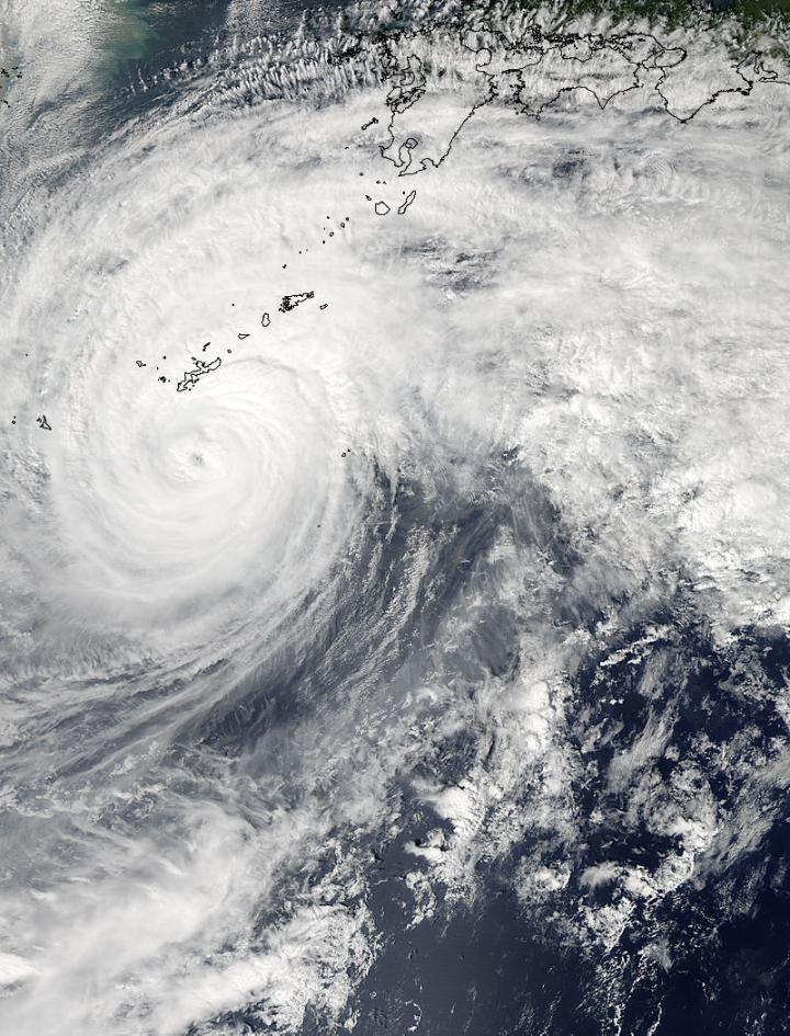
NASA's Aqua satellite passed over Typhoon Vongfong on Oct. 11 at 04:15 UTC (12:15 a.m. EDT) as it was approaching Japan's big islands.
(Photo Credit: Image : NASA Goddard MODIS Rapid Response Team)
Forecasters at the Joint Typhoon Warning Center noted on Oct. 11 at 5 pm EDT, that radar showed the overall structure of the system has started to deteriorate and become elongated. The strongest winds were located on the northern side of the storm. For current warnings and watches from the Japan Meteorological Agency, visit: http://www.jma.go.jp/en/warn/.
Over the next two days, Vongfong is forecast to speed up and become embedded in the mid-latitude westerly winds, which will cause it to spread out and look more like a frontal system as it changes into an extra-tropical storm.
The Joint Typhoon Warning Center forecast calls for the center of Typhoon Vongfong (as a tropical storm) to track over the island of Kyushu, then Shikoku, then the big island of Honshu, on which the capital, Tokyo, is located. Vongfong's center is expected to the west of Tokyo, moving northeast, and exiting back into the northwestern Pacific Ocean south of the city of Misawa.
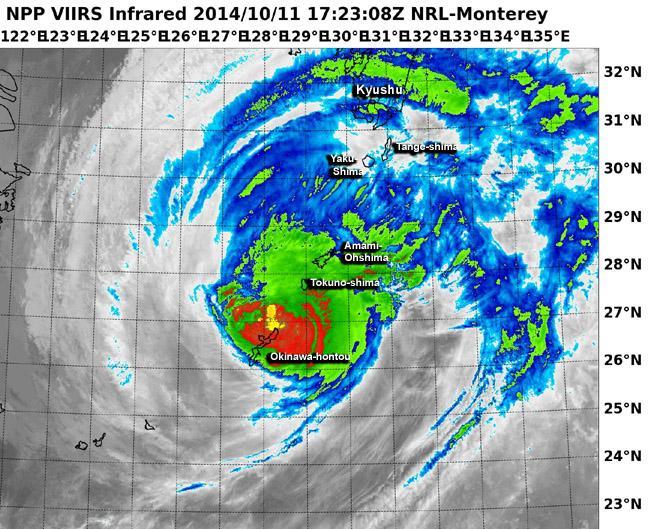
NASA-NOAA's Suomi NPP satellite passed over Vongfong on Oct. 11 at 17:23 UTC (1:23 p.m. EDT) and saw the strongest thunderstorms were in the northern quadrant of the storm.
(Photo Credit: Image : NRL/NASA/NOAA)
Source: NASA/Goddard Space Flight Center